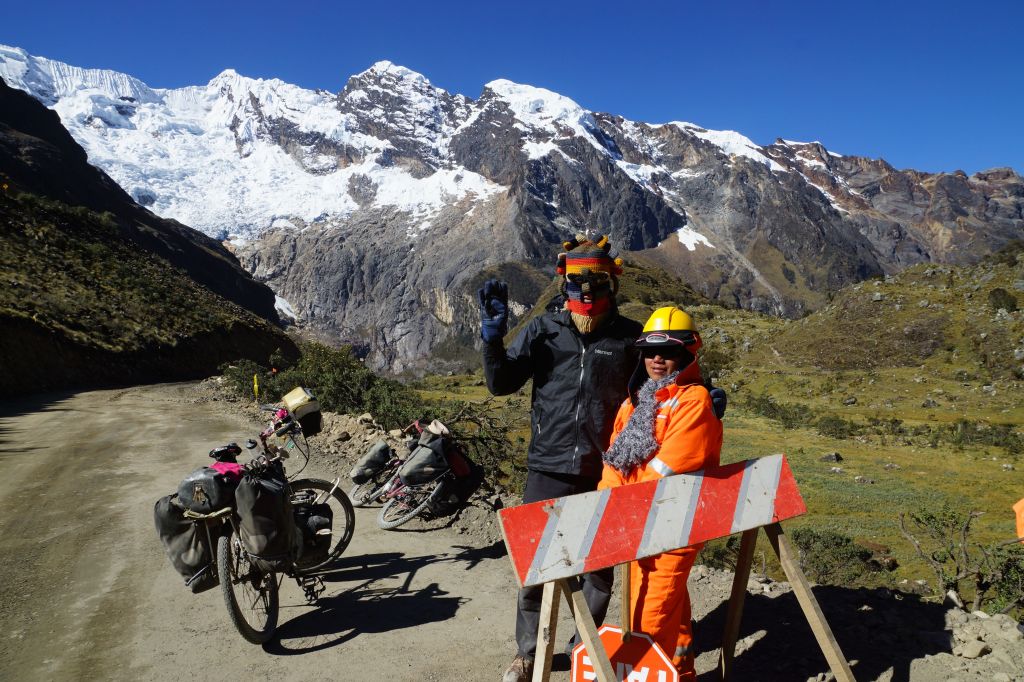
Well Peru has cranked up the volume on the scenery another few notches as the road cuts through the Huascaran National Park and the magnificent Cordillera Blanca mountain range. The ride across the range is one of the highlights of the Peru part of the trip and the Punta Olimpica Pass that crosses the range is a rare beauty with a long climb up to 4,950 metres and the twin glaciers near the summit. I set out up the pass with Jose and Corinne and then meet Eric again at the top of the pass (refer photo).
On the eastern side of the Punta Olimpica Pass the road turns south and then there is some zig-zagging along some pretty back roads with virtually no traffic for a few hundred kilometres to the south-east towards the main road south. The ride is four and a half day’s ride over some nasty loose rock/dirt roads and another beautiful mountain pass (4,400 metres) and then a plunge down through 2,100 metres to and the city of Huanuco nestled in the valley below. I managed to get snowed on as I camped at the top of the second pass and had a pretty cold descent. There is some footage of the Ponto pass at a time when I was a tad tired, and some of the abortive camping attempt at the top of the same pass on the attached video.
Huanuco is a chance to rest a day or so, eat something that isn’t chicken and chips and also indulge a new-found timely interest in bike maintenance (I blame Eric).
Ecuadorian Cyber-GodRocks at top of Ponto PassEric and Buff3y at the top of Punta Olimpica Pass at 4,950 meters.Glacier at Olympic Pass
Lovely roll down below LlataTop of Pass at 4,950 metresHighest porta-potty in the world at 4,800 metresPass above PontoCyber-man Hug
Regular readers of this blog will understand how it pains me to ‘big-up’ any of the incredible feats of dering-do that I am somehow able to perform as part of this bicycle trip. They will therefore appreciate that this posting is going to be complete and utter torture for me because the road running South-East from Cajamarca afforded your correspondent the opportunity to get well off the well-worn track and in doing so redefine what adventure cycling is all about. This is wonderful canyon country and here Peru delivers stunning landscapes with rivers carving down through high cliff walls, dirt tracks winding through harsh dry land with steep cuttings, tiny bridges and 100 year old tunnels on the road up towards the Cordillera Blanca mountain range and its picturesque snow peaks.
View down to MollepataRoad south of Mollepata
The ride out of Cajamarca was one of the more frustrating of the trip to-date in that on receiving directions to ‘Cajabamba’ (or so I thought) I cycled off in the wrong direction towards the hill side village of ‘Cashapampa’, the victim of my own overly enthusiastic pronunciation of a ‘J’ and my informants’ misunderstanding of a couple of plosives. One and a half hours and 300m of futile climbing later I’m back where I started. I then decide to naively believe that the red lines on my map actually represent roads (silly error), so I head off on a (represented) secondary road just to discover some two hours later that the lines actually represent bugger-all and the road terminates in some mountain village. So back I turn yet again. Then, just to make the day’s riding a complete farce, I believe the directions of some prat and head off on one last fool’s errand to another dead end. At 4pm I’m back again at the 5km mark out of Cajamarca, exactly where I was at eight o’clock in the morning, feeling somewhat sorry for myself. I decide to retreat to the relative certainty of the main road south just so that I might go to bed with some distance covered. The upshot is that a total ridden distance in idiotic circles of 106km was covered for a mere 33km gain in road distance. Oh crumbs!
Scrambling to the river
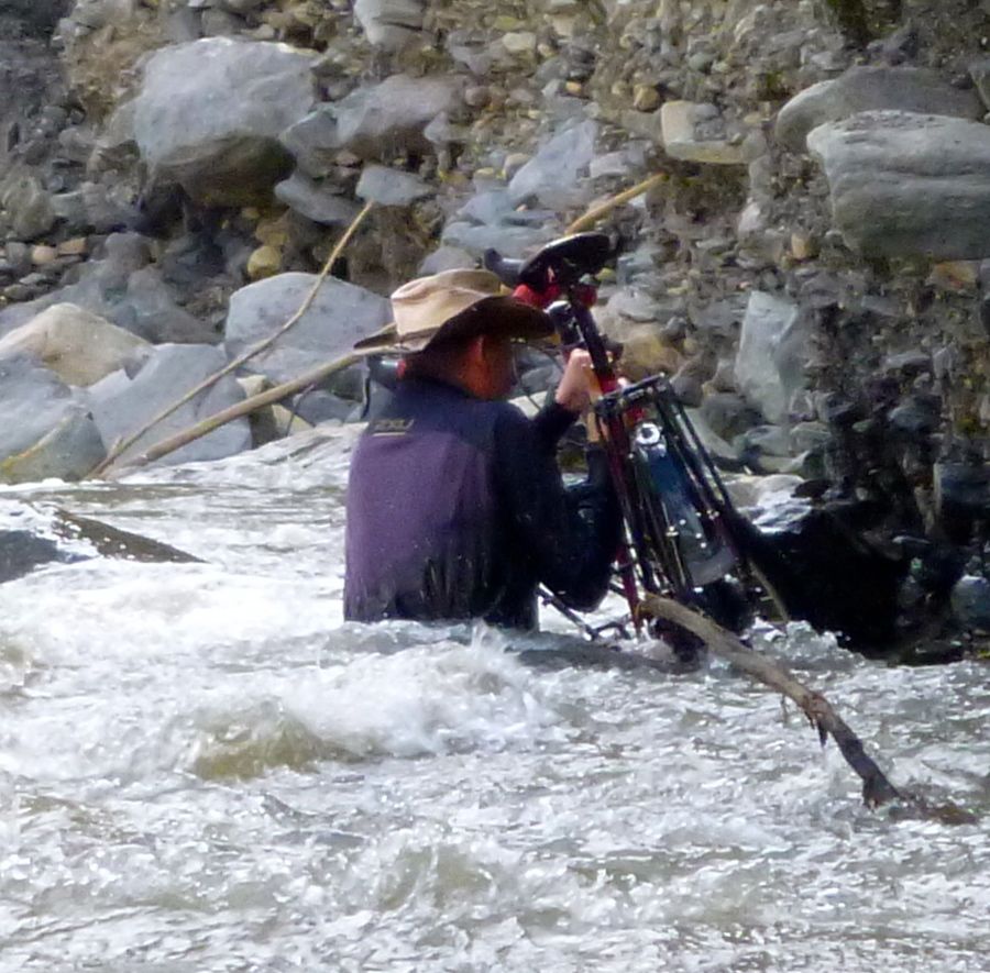
It’s difficult to adequately convey just how gob-smackingly beautiful the ride into the river valleys south of the little town of Mollepata really was. Classic dirt road with tight switch-backs snake down for 10km to a turnoff from the main dirt road onto a track that then follows the Chuquiera River southwards towards what turned out to be a particularly challenging river-crossing obstacle just 15km further down stream. A French/Swiss couple (Eric and Lydie) are my cycling companions for this part of the trip having met in Mollepata and we camp just prior to the first river crossing.
The following day was to prove one of the most challenging of the whole trip and in the morning we coax the bikes over the ash and shingle down to the river bank and assess the troublingly fast water flow. Undaunted, the bikes are unpacked and we begin the energy-draining task of transferring pannier bags, bikes and people across what was a pretty strong river flow. Just a few inches higher and the river would have been completely impassable meaning a depressing turn back up the canyon to the turn-off, something I am always loath, and am usually too bone-arsed stubborn to countenance. It is no exaggeration that there were a couple of moments in the midst of the river where the possibility of being swept away became more than a theoretical concept. Worse still, the Co-Motion might have been damaged!
The first crossing complete without incident we proceed along the far bank for a short 4km before the next obstacle where the whole bank and the track along with it has recently been completely washed away after a landslide, leaving no clear way to get beyond. With no obvious river re-crossing point we are faced with a dilemma; turn back and take a large detour up and over some ugly switch backs, or get into the river and scramble along the edge for about 25 metres to get beyond the landslide area; not an enticing prospect. But there is no viable option if we are to continue. This is a big decision as the river flow is strong and there are a few places where we are up to our waists in churning water. Above our heads the remnants of the track hang precariously waiting to deposit more than a few tones of rock and dirt on our adventurous but foolhardy heads.
Still, on we plough. (refer photos). Each pannier bag transfer took about 15 minutes to complete and hauling the bikes through the water was not an experience I’d like to repeat any time soon. However, a mere 2 hours later we are exhausted and actually still on the same side of the river from whence we came, but we have somehow got ourselves and all of the gear beyond the seeming impasse without drifting off down stream or losing more than one one fuel bottle which floated away from my bike in transit. Only one more re-crossing of the river to go and we should be clear to go on. We find a decent place and get back across the river 1km down-stream with now well practiced relative ease and then scramble back up onto the track leading south along the canyon. The upshot is that we covered a total of 15km for the day, made two river crossings and one non-crossing), so we camp, exhausted but happy to have made it through. The reward is then being treated to some beautiful canyon riding; first down hill for 55km along side the RioChuquiera and then cut upwards into the Rio Santa gorge and then on to the more famous Canyon Del Pato before reaching Caraz.
An opportunity to reassess one’s life choices
The old body was feeling a bit ragged after the ill-treatment I’ve dished out to it over the nine day ride from Cajamarca. The mountain trekking /tourist base camp city of Caraz is therefore a very welcome location to rest, do some maintenance on the bike and unpack all of the gear (and of course reassess one’s life). Real coffee, tourist food and a relaxing sunny court yard of the hostel are just the tonic. Not using one’s much-abused legs for anything other than the bare minimum distance it takes to get between bed and coffee are the order for the next couple of days.
Rio Santa canyonCamping after the river
STOP PRESS: ‘Fritz The Cat’, the catamaran that managed to transport me and the bike from Panama to Colombia just sank! (all crew and passengers rescued.
Guide books usually kick off an introduction by saying something nice about the population of the country to be visited. In the case of Peru this appears to have been a bit of a challenge and the best that my edition of Lonely Planet could muster is to describe the people as “stoic”. They obviously heavily edited the first three drafts which no doubt used far less flattering terms, ‘a tad irritating’ figuring prominently. This would certainly have been a more accurate description for a good contingent of the inhabits the stretch of country surrounding Cajamarca in the north, or ‘Big Hat Country’. These hats have rims big enough to pick up satellite TV; not quite in the Mexican sombrero class but getting out there.
Big Hat market in Celendin
Under the huge brims of the ludicrously over sized head-ware, the people are (as I found to my chagrin) capable of colossal feats of collective stupidity. In the face of the multiple Klepto-crats Peru insists on electing (Keiko Fujimori almost recently won re-election!) and the general lack of trust (justified evidently) in public institutions and more general social breakdown, people do tend to close ranks around family and clan and behave in less civil ways to others outside these groups. Regardless, I consider that the way the visitor is treated is a measure of a people and sadly the Big Hats are lacking in some of the more simple social graces. However, the choice of local tourist slogan: ‘We’re all a bit dim but the scenery is nice’ does appear to be a bit OTT even here.
People with an inflated sense of the importance of political correctness will no doubt email and spout inanities along the lines of, ‘There is good and bad in all of us, People are the same wherever you go’, but they just need to ride a bicycle in Peru for a little while to discover just how very wrong they are. Perhaps the percentage of the population here allocated the responsibility of being dickheads (e.g. mini-van conductors/touts) merely take to their work with more enthusiasm than in other parts. Not sure. I would add (merely as a token and belated attempt to appear fair-minded) that riding south of big hat country the atmosphere is more relaxed and the people more welcoming.
12km beyond The Valley of Instant Death is the lively little city of Celendin with its population of Big Hats sporting the required unfeasibly large head-wear (refer photo). There is a friendly atmosphere and the streets are replete with cartoon motif painted cyclo-taxis. There is, however, a bit of unrest in town and beneath the festive veneer of the local band playing in the central square there is an angry undercurrent of discontent over government plans to develop a US funded gold mine at Conga that supposedly threatens the local water supply. ‘ Conga No Va’ is the repeated call and the large rimmed Big Hat contingent is out in some force to protest. There are speeches etc and even a group of youths doing a display of street rampage but with little conviction and no damage.
Big Hat protest
It was in this context that your hapless correspondent wonders out mid afternoon to see what’s going on. On seeing others using cameras, it was then that I made the error of taking a photo thinking that as I’m a long way away, that it would not be an issue. I couldn’t have been more wrong. Once identified as obviously being a representative of exploitative imperialist pig-dog-yankie gringo miners, a few Big-Hats start moving towards me in an increasingly menacing manner and this soon turns into a determined stampede of about fifty morons, their huge brims wobbling as they descend upon your correspondent. I do not exaggerate when I say that I was a might perturbed when, once surrounded, a couple of big-hated twits start grabbing for my camera. It’s all getting a bit ugly.
A few tense moments ensue but my fluent Spanglish prevails and without much more violence than my shoving an overly zealous little Big-Hat away from my camera, I’m able to show them the ‘tourist’ photos (that were fortuitously still on the sim). They relax a bit and it is then that the situation suddenly takes a turn for the Pythonesque. I am then ushered to the stage and handed a microphone so that I might address the crowd in what can only be described as some pretty stressed Spanglish. Bugger me! What to say?
“I am a tourist from Australia” (some clapping)
“You have a lovely city” (more applause – thank the Great Lord Harry)
“Agua es Viva” (Water is life!) (more clapping); [I’m struggling now]
“Conga No Va!” (more applause).
Monument to Big Hats
Survived! I can understand people not wanting their pictures taken individually and perhaps I do represent everything ugly in terms of Americano Gringo imperialist first world exploitation of South America, but having a bunch of hyped-up Big Hats turn on the nearest tourist is pointlessly aggressive and more than a little bit silly.
With the crossing of the Maranon River negotiated via the good ship ‘Not Very Good’ I decided to head off on a circuitous route to the south-east into the Amazonas region.
Crossing The River Maranon
Chachapoyas, the capital of the Amazonas Region is a charming highland town with a lovely central square. There are many tour operators offering to take you to various ruins and natural phenomena (waterfalls and valleys etc) but I opt for spending a day riding the local mini-bus on a white-knuckle ride up to see six Sarcophagi perched on a cliff. After all of this bike riding I am now a very bad passenger.
Sarcophagi on the cliff faceKuelap ruins
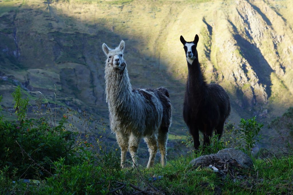
What was supposed to be an easy day of a mere 38km to Tingo and a bus ride up to the ruins at Kuelap somehow turned into a night riding test of endurance. There are two ways up to Kuelap; one is a gentle climb of 1,300m over 35km. The other is a steep walking track of 10km. With no mini-buses to be had I decided to leave the bags in Tingo and do the 35km ride up to the fortress. This was all well and good and the time at the top was successfully spent photographing llama and deepening my appreciation of pre-Incan architecture. The pivotal moment for the day came when I decided to return via the 10km foot-track. Little did I know that this track, with the addition of a little rain-water, would become a quagmire of mud that was more clay like glue than mud. Before very long the bike was completely encased in the goo and the wheels absolutely refused to budge as the glue set hard around them. The afternoon drifted into night and the likelihood of being stranded on the hillside started to become a very real possibility. On this descent I also managed to chalk up my third crash of the trip (Mexico; truck avoidance, Honduras; steamroller avoidance. Peru; face plant in a bush). The major damage was to my legs in terms of fatigue in that lugging a reluctant bike down the steep hillside for 10km pretty well did for the old legs. The next day’s ‘easy’ ride of 48km gently rising along the river valley to Leymebamba therefore became a bit of a test as the legs were utterly toasted.
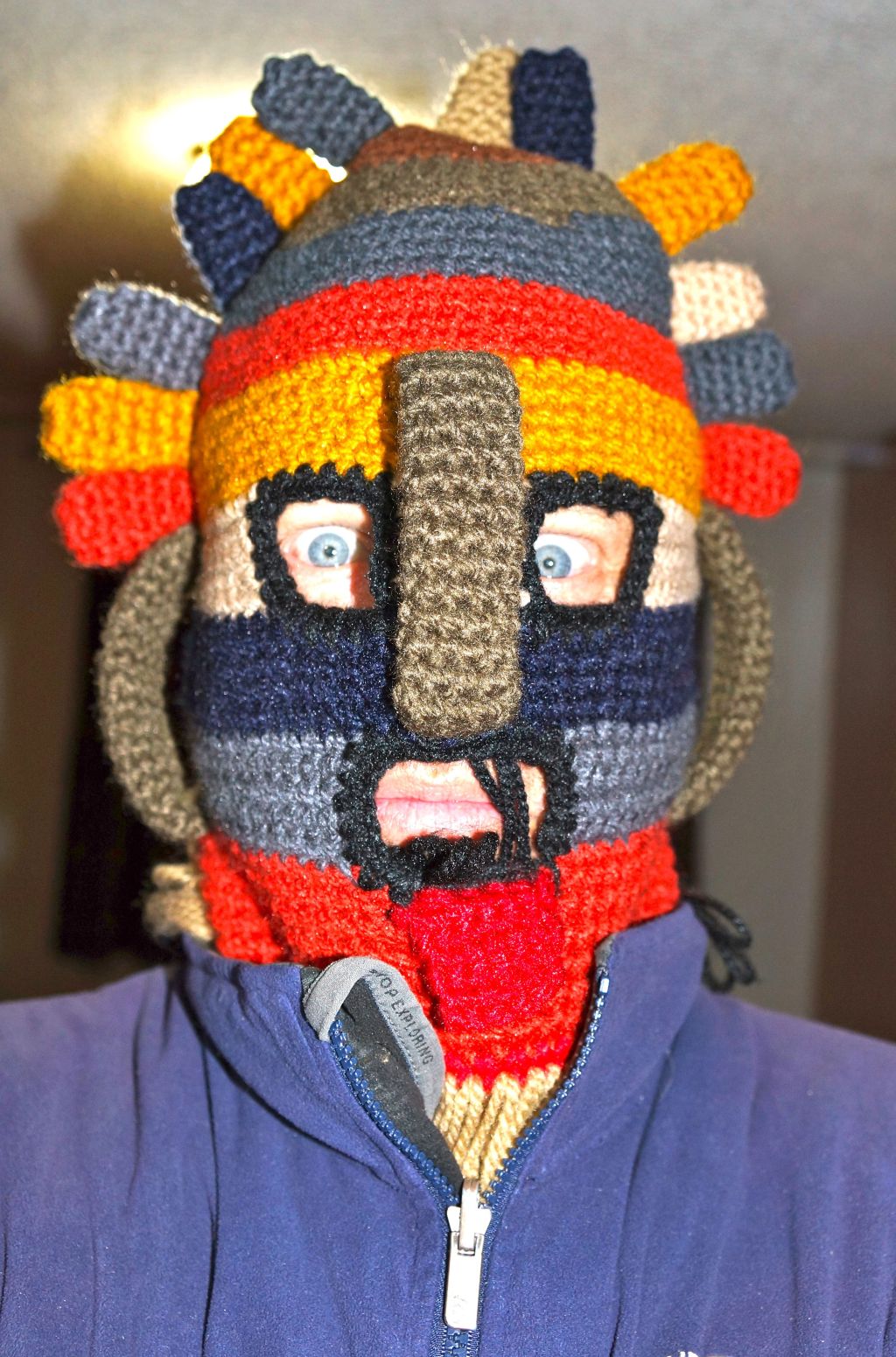
The valley between Leymebamba and Celendin (AKA ‘The Valley of Instant Death’) is two days of wonderful scenic riding. 29km from the very friendly town of Laymebamba (at 2,200m), the dirt road goes up and over the lip into the valley followed by a long rollicking plummet into the valley was an awe inspiring valley ride. At the pass at ‘Calla Calla’ (which means ‘Instant Death’ in the local dialect) at 3,600 metres, the rain and cloud are tearing across the road (refer photo and video), so the Cyberman/sun god mask is put to good use (refer photo). Some small kids see the mask and run which is odd given that there must have been Dr Who contact at some point in history as many people here still say, “Good Tardis”. From there it is just stunning scenery down to the river crossing at Chalas (870metres). The ride out of the Valley of Instant Death was truly stunning. Zig zagging for 2,200 metres up the valley slope where you can easily look down on the town below after 43km of riding.
Calla Calla PassTop of the Valley of Instant DeathZig Zag road up the valleyUpper Valley of Death
Cuenca is a belter of a city with charming hole-in-the-wall bars and eateries and a good smattering of churches and squares. The festival of something-or-other is on while I’m there so the sweet sellers are out in force.
In the little town of Villacamba you can relax in the main square with the hippies, the want-to-be hippies and the traveling refugees, kick it back about three gears and soak in the friendly atmosphere. It’s a lovely place to unwind and the locals are very welcoming. They are supposed to live longer than the rest of us, or this has reportedly been the case in the past though a local says that it is no longer really true.
Onto a winding dirt road cum track and some pretty steep gradients towards the southern border with Peru, emerging in the dusty working city of San Ignacio two days later. Due to some construction land slides the ride into San Ignacio was a very late finish so am arriving in the dark, something I loathe, a bit sore in the legs from the experience so thankful of a day to rest before the higher peaks to come. Therefore I cross the border into Peru and into the higher Andean passes of between 3,000 and 4,000 metres; things to relish in fear in equal measure.
Winding road near the Peruvian border south of VillacambaCuenca central cathedral with storm cloudsNot really the best way to cook a pig – with predictable results
There is, of course, at this juncture in the travel south, a decision to be made. One can travel southwards along the spine of the Andes, staying high all the way through Peru to Lake Titicaca and the 4,000metre plateau into Bolivia. Alternatively, on crossing the border into Peru one can soft-core it down towards the coast and Trujillo, then skirt along the coastal route, mincing their way along the effortless flat whilst living the beige life amongst the commuting drones. It would be difficult for a cyclist such as myself to countenance such an abrogation of one’s sworn hard-core duties, (and indeed continue to bear the epithet) therefore one must take the high road, so high it is. It’s a lot of climbing but my thinking is that you probably only get one chance in life to bike the Andes (would one really want another?) so it’s worth doing right.
Yet those neat and trimly dressed on the low coastal road might hold their manhoods cheap not to be in these mountains with Buff3y this day. These perfumed popinjays might take pause from their pamperings and peer skywards towards the mountains to the East and see if they can make out a distant figure high in the mist, proud bearer of the standard of all that is good, just and right in touring cycling. If they do they might glimpse we two, we happy two, (the Co-Motion and I), doing glorious battle with yet another peak.
6th June Quito – San Miguel Salsedo (104km) 1,144m
7th June San Miguel Salsedo – Riobamba (86km) 1,389m
8th June Riobamba -Alausi (92km) 1,282m
Today was everything good in a bike ride. The beautiful highland meadows of the Ecuadorian Andes. The roadside villagers reaping away merrily as they have done for generations. A helpful following breeze. Some rolling hills but nothing too arduous. Then a nice long roll into the town of Alausi where you can find the PanAmerican Hotel for $10 (with WiFi!) and a pizza place just metres away. If the public thermal Spa had had any water in the Hydro-massage tub then it would have been an absolutely perfect day, but that was just too much to ask for. The town is shrouded in cloud in the late afternoon by the time I get there giving it a very spooky atmosphere.
9th June Aluesi – some house (41km) 2,665m
Today’s ride is a tragic-karmic tale. The early morning was a lovely romp up and down through a gob-smackingly lovely valley south of Alausi. The Pan-American Highway splits and a friend on the biking road, Ian Lacey (Irish cyclist 350south.org), a week ago listened to the dud advice of the locals and therefore took the longer and more difficult route to the East. Buff3y, fore-warned took the shorter and less arduous route which saved a good hour of pedaling.
It is now a matter of much regret for me that I took some time to take video of the roll down through the valley (see linked video), while lambasting Ian for listening to the locals (who have less of an understanding of the supreme importance of road topography than your average touring cyclist). I deeply regret this now because I was in the midst of one of these video tirades that I brilliantly managed to miss a particularly important turn-off and ended up a good 10km off course careening down through an adjacent valley. By the time realized the error I was hundreds of metres in elevation down the hill to the West. I pedaled back up to a different turn towards the desired town this time only to then discover that this road became a dirt track snaking up some horrid horrid grades. The whole episode cost me about two hours riding and lots of sweat. I emerged back onto the PanAmerican 20 km further back on the road than should have been the case which just about kicked the stuffing out of the whole day.
The moral to the story is that karma or St Patrick will get you in the end. Had I not been taking the piss out of Ian then I wouldn’t have missed the turn and I wouldn’t have wasted over an hour grinding back up that hill and then wouldn’t have been on that dodgy alternate route that pretty well did me in.
10 June Some house – Cuansa (110km) 2,239m
Street march in QuitoMarvelous pork crackling for $1.50BBQ Giant RatHalf Giant Rat Platter with potatoes, butter and corn
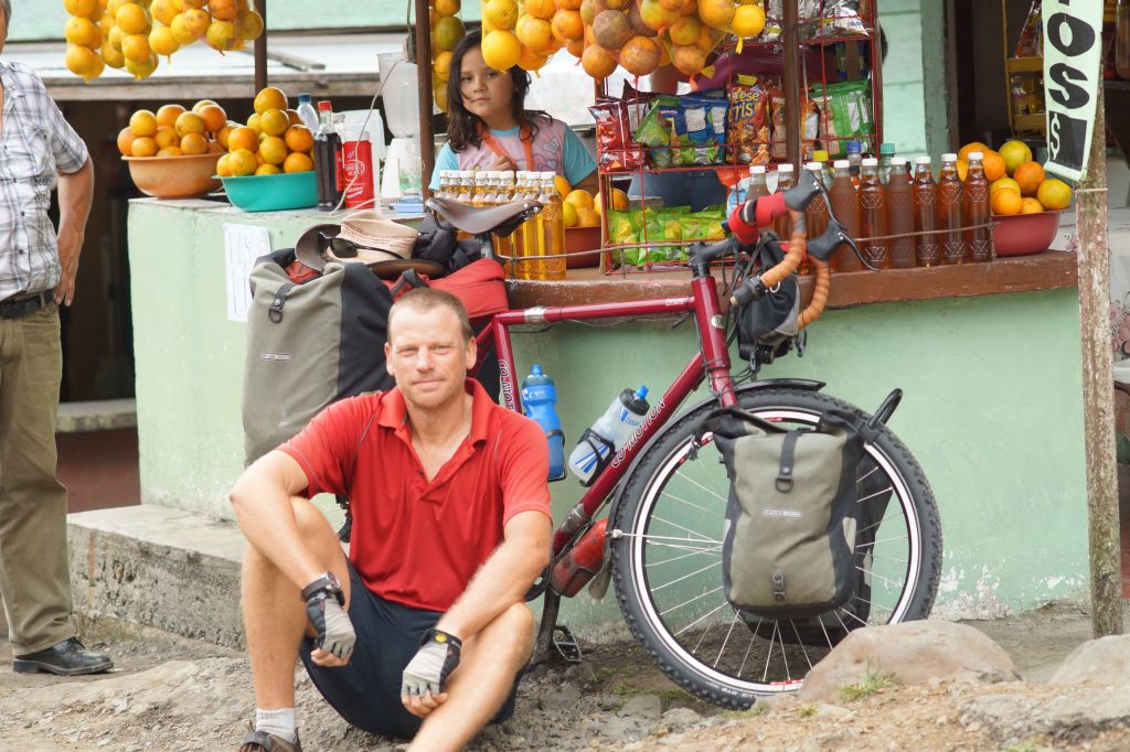
I do, of course, appreciate that one of the broadening experiences of travel is, in theory, trying new foods. In southern Ecuador, in one day I got to sample some of the best pork on the planet at a road-side pig spit. I then followed this up later in the afternoon with a plate of giant rat . The trouble is that the giant field rat of southern Ecuador is a pretty active beastie and therefore it doesn’t have a lot on it apart from a lot of tough skin and gristle. Once you’ve hollowed the innards and skewered the poor blighter on a spike there is not a lot left. Despite being particularly brave there is no way this correspondent is going to bite into a charred rat head so as the guy next to me chomped happily through the rat face he gave me dismissive glances as I merely picked away at my rat. A terrible waste really as rat is a bit of a local delicacy and cost $8.
Winding trackFurry Andean llama south of Alausi.Only one place to stay really in Alausi – The ‘Hotel Panamericano’.This one is just plain wrong.
It appears that since I threatened to appear nude on buff3ysbicyclingblog that the click figures have taken another huge spike. There can be no other possible explanation. We now have hundreds of people each day enriching their lives through following the adventures of Buff3y the hardcore solo adventure cyclist.
Soviet-style monument to sharing the love – northern Ecuador
The town of Bolivar (about 70km south of the Colombian border) boasts a fine collection of municipal kitsch sculpture. One is the finest example of an excuse to render bare breasts in the history of misguided public artwork (refer photo). You couldn’t really hope for a sleepier town and the ten or so residents who bother to hang around the central square in the middle of the day all carry similarly bewildered/resigned expressions indicating that they may have mistakenly been beamed in there. The sculpture campaign has been such a resounding success that Bolivar boasts a grand total of zero hotels. Must ride on to find accommodation further down the hill.
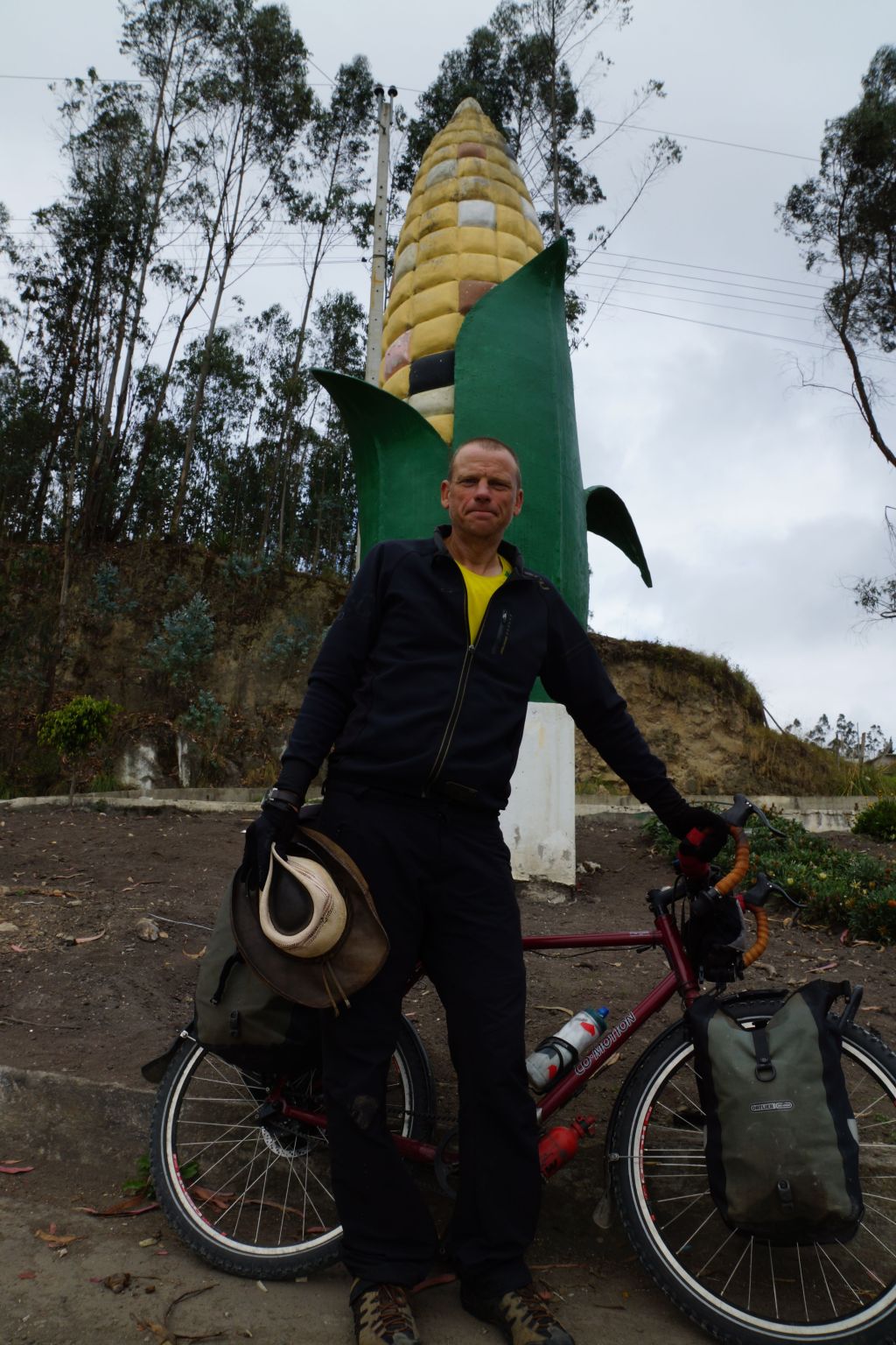
A worrying trend in my photography is just standing in front of easily ridiculed public monuments and photographing myself with my bicycle. What the hell- it’s the small things along the road that make it all worth while.
The first exposure of the Inca civilisation to the Cybermen is of course still a subject of sometimes very heated academic debate. Some point to the difficulty in determining time lines in an environment where time lords may screw with the space-time continuum as a reason for there being no consensus to this day on when the exposure occurred. Suffice to say for our purposes, however, that the visits have left an indelible impression on the artwork of the people up to the modern day, especially the head wear which includes the Raymi sun-god mask (refer Cyberman mask photo).
Anti-pollution street drawing – QuitoSundays the central part of Quito is closed off to traffic so people can ride their recumbents.Old Town QuitoSunday 15km fun-run in central Quito (I did not participate)
The market in Otavalo is a treasure trove of handicrafts (and cyber-man woolen masks). Every Saturday the population of the town swells and the central streets become packed with vendors and bargain hunters. For me it was a good excuse to rest up for a day and take in the sights.
There is a long climb up to 2,850 metres to get into Quito and the setting is a magnificent one for a city of this size. The centro-historico is no place for a wondering tourist at night but during the day its a pleasant enough place to relax and enjoy if you have the breath. Will check it out tomorrow before forging on southwards into more mountains.
Peasant dancing monument – OtavaloCyber-Inca/Raymi woolen mark/hat. “You know our ways. You must be destroyed! We have very warm heads!”Hats in Otavalo‘Yes, we have many bananas’ – OtavaloPoor excuse to sculpt tits – Bolivar EcuadorVegie Stalls – OtavaloStern looking cook but good rice/chicken stuff for $1.50 -OtavaloCyber-rider in OtavaloOtavalo Market‘Curly Land’ – Leunig would love this monument on Colombia/ Ecuador borderPrimordial squiddy looking thingHunters attacking saber-toothed tiger – BolivarBolivar Jesus relief
It is with a heavy heart that I now bid a fond adios to Colombia. I’ve tarried here far longer than originally planned, but somehow even before arriving suspected that this place would be as beguiling as it has turned out. Oh, there are of course the lovely ladies, and the women folk are also something very special indeed. Throw in a good smattering of charming colonial cities, lush pretty countryside and people who are helpful, friendly, relaxed and engaging then you really couldn’t wish for much more in a country. Not to mention the good cycling road shoulder, serious cyclists out on the roads and traffic that is, in the main, courteous. However, as I leave, I am still left with some serious questions:
Why is it that no cheap Colombian hotels have shower-heads?
Why is it that people put pineapple (and in Pasto, even marmalade!!) on pizzas?
Why don’t more people appreciate my salsa?
Why is it that in the local music videos the farm boy crooners strut their beer guts while local scrubbers wave their voluminous posteriors about the place and this is considered good?
Why does no one here appreciate that never has a banana been improved by frying it?
Caution – Footballers on roadCentral Popayan
Popayan is a cracker of a little city with a huge collection of white-painted colonial buildings around the city centre. It is a modern sophisticated place (being a hardcore cycling adventurer I know sophistication when I see it). As such it sports a large number of museums and galleries and the local people seem to have perfected the art of looking at truly average art works and pretending to see something of value in them where no such value exists – a skill I have never really mastered.
Popayan DoorwayHigh Road on the way to PastoCycling Fuel of Colombia – note bananaLovely oily potato soupOrange drink stalls like this one are a god-send half way up a big hill
South of Popayan
I’ll miss this place very much as I head south into the high Andes. I just bought a map of South America and I am usually a great lover of maps. This one, however, has me a little perturbed in that the road south is still very long indeed and a lot of it runs through the centre of the brown and white that denotes huge elevations. This is a double-edged sword in a way; the Andes of Ecuador, Peru, Bolivia and Chile are both daunting and enticing at the same time. I do enjoy a good climb in a masochistic sort of a way – it’s just that it looks on this map like they go on forever! Over 4,000 meters in places it is as high as the Tibetan plateau and unlike a plateau the rises and dips appear unceasing up to Bolivia where the salt plains might be a respite.
I must add to this post (again, in the near-constant pursuit of self-glorification) that your most humble correspondent has now become the pin-up boy for custom made bicycle manufacturing. Yes, out go the scantily clad, shock absorber fondling busty scrubbers in barely visible swim suits and in comes your T-shirt clad correspondent sitting on his arse next to his bike! I balked (this time) at the idea of a series of nudes, but what the hell – if the coming Andes steel-up the buns sufficiently I might reconsider, I just hope that the good folk at Co-Motion Cycles will be able to handle the influx of orders!
It also appears that cycling fame is short lived in this day and age. The spike in hits on my site that sent me into such excitement has come crashing back down to earth, my ego along with it. Might just have to write another article for the newspaper. Regardless, it is for you my loyal clickers that I toil away week in week out bringing you these rare insights into the world of bicycle touring and the human condition.
Finally managed to extricate myself from the comforts of Medellin after two weeks of redefining what it is to dance the salsa. Am now back on the road heading south with a renewed vigor and an expanded girth. It’s amazing just how much condition you can lose with just a couple of weeks of excessive coffee, beer and pizza eating (conceivably age related? surely no). This and a bit of a cold made the nasty little climb out of town all the more difficult but then there was a flat run south to Cali over the following three days.
The Colombians continue to be a friendly bunch along the road. A guy on a motorbike pulling in alongside to offer up mangoes seems less odd than it did a few weeks ago. Medellin has a well deserved reputation for the friendliness of its people and the time that I spent mooching around the Parque Liares certainly reconfirmed this. I was also able to do a little side trip over to the thriving national capital, Bogota to visit Nick and Julianna for a couple of days and check the place out.
Colombia continues to be a treat to ride with a wide shoulder and lovely people and views along the way. Cali is a rough and ready city throbbing with salsa rhythms and a grimy understated charm. Its a great pit stop for a couple of days before heading into the mountains to the south. Am busily trying to lighten the load even more before spending whole days chugging up hillsides. The Schwalbe marathons are now fitted replacing the chinese jobbies that are now happily discarded
There is about 500km to the border with Ecuador and then a couple of day’s ride to the capital Quito, the next pit stop on the road south. The mountain roads that await in Ecuador and Peru will trace a path along the spine of the Andes that will I think be the toughest riding of the entire trip. The road in Ecuador will roll between 2,000km and 3,000 metres in elevation while it gets all the better in Peru which will be between 3,000 and 4,000 metres. Should be interesting. On-on.
Top of the hill south of MedellinWhen too much green is barely enough – the mountains of ColombiaBogota Street Scene
.
Buff3y & Dali. Think this one is called, ‘Woman with bread stick on head’Buff3y with a Miro in Medellin
.
Rock Falls aplenty along the road south of MedellinA large number of birds
Well well! Having previously joked about this blog being “the fastest growing bicycling blog on the web” (when in reality only my mum and a couple of people mistakenly looking for vampire slayers were logging in), I might now have to reassess.
With the publication of a little article on the trip in some of the Australian media (link above), buff3ysbicyclingblog has just gone completely viral! If people are actually going to look at this blog I might have to sharpen up my act a bit, i.e. get serious and take some of the less than polite language and commentary out of the postings. Or not.
To celebrate my belated (but, of course, much deserved) elevation to the realm of bicycle-touring and international media super-stardom, I’ve finished off a little video clip. Given that I’m now in Colombia, I gave it a bit of the Latin rhythm treatment. See link below.
Production: Bob ‘Buff3y’ Stanley
Camera: Bob ‘Buff3y’ Stanley
Editing: Bob ‘Buff3y’ Stanley
Gripping: Bob ‘Buff3y’ Stanley
Bicycle riding: Bob ‘Buff3y’ Stanley
Music: Fruko & Sus Tesos playing ‘El Caminante‘ from Historio Musical de Fruko 1 [L@tina Music]